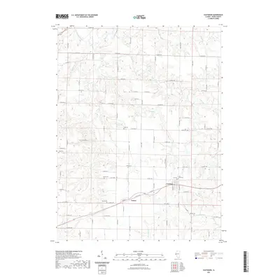
2021 Map of Coatsburg
USGS Topo · Published 2021About this map
The agricultural villages of Coatsburg and Paloma anchor this survey of Adams County, where the prairie begins to break into the drainage systems of the Mississippi and Illinois rivers. The landscape is defined by the winding paths of South Fork Bear Creek, Brushy Cr, and Honey Cr, which carve deep contours into the otherwise level farmland. For genealogists, the map is remarkably dense with family-named burial sites, including Gray Mound Cem, Cate Family Cem, and the Johnson Cem. These small, scattered cemeteries reflect the early pioneer settlement patterns of the region, often located on higher ground near the heads of seasonal creek branches like Honey Br. The rural road network, following the traditional section lines of the Public Land Survey System, provides precise modern access to these ancestral landmarks and the surrounding countryside.
Find a feature on this map
81 named features on this map. Tap any name to fly to it.
Don’t see what you’re looking for? This feature index may not catch every label — zoom into the map to look around manually.
Map Details
Editions of this 2021 Coatsburg Map
This is the sole edition of this map. No revisions or reprints were ever made.
Other maps of this area

1925 · Quincy
USGS Topo · 1:62,500

1925 · Liberty
USGS Topo · 1:62,500

1927 · Liberty
USGS Topo · 1:62,500

1944 · Quincy
USGS Topo · 1:62,500

1945 · Quincy
USGS Topo · 1:62,500

1946 · Mendon
USGS Topo · 1:62,500

1948 · Quincy
USGS Topo · 1:250,000

1948 · Mendon
USGS Topo · 1:62,500

1948 · Camp Point
USGS Topo · 1:62,500

1956 · Quincy
USGS Topo · 1:250,000