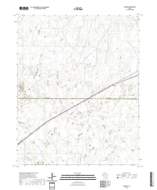
2022 Map of Coburn
USGS Topo · Published 2022About this map
Coburn marks the central focus of this High Plains landscape, situated along a prominent rail line that cuts diagonally across the terrain. The map documents a sparse, rural environment where the open range is defined by intermittent drainages such as Canyon Cr and the invisible boundary line separating Lipscomb Co and Hemphill Co. Transportation infrastructure in this portion of the Texas Panhandle is concentrated along primary arteries like Co Rd 18 and Ranch Rd 2758, which provide access to the expansive agricultural and ranching lands that dominate the region. The detailed contour intervals reveal the subtle draws and breaks that characterize the local topography, offering a clear view of the land's natural drainage patterns and the isolated nature of the settlement at Coburn.
Find a feature on this map
5 named features on this map. Tap any name to fly to it.
Don’t see what you’re looking for? This feature index may not catch every label — zoom into the map to look around manually.
Map Details
Editions of this 2022 Coburn Map
This is the sole edition of this map. No revisions or reprints were ever made.
Other maps of this area

1954 · Perryton
USGS Topo · 1:250,000

1954 · Amarillo
USGS Topo · 1:250,000

1958 · Perryton
USGS Topo · 1:250,000

1958 · Amarillo
USGS Topo · 1:250,000

1972 · Canadian East
USGS Topo · 1:24,000
1972 · Higgins North
USGS Topo · 1:24,000

1972 · Glazier
USGS Topo · 1:24,000

1972 · Willow Creek
USGS Topo · 1:24,000
1972 · Lake Marvin
USGS Topo · 1:24,000
1972 · Dreyfoos
USGS Topo · 1:24,000