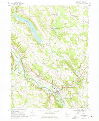
1967 Map of Cochranton
USGS Topo · Published 1975About this map
Cochranton occupies the valley floor where the Erie-Lackawanna railroad follows the winding course of French Creek. This mid-century landscape is defined by its transition from industrial rail corridors to the agricultural highlands of East Fairfield and West Mead. A significant geographic feature is the elongated basin of Tamarack Lake, which stretches through the northwest, bordered by historic family crossroads like McNamaras Corners and Pettis Corners.
Find a feature on this map
65 named features on this map. Tap any name to fly to it.
Don’t see what you’re looking for? This feature index may not catch every label — zoom into the map to look around manually.
Map Details
Editions of this 1967 Cochranton Map
2 editions found
Other maps of this area

1909 · Franklin
USGS Topo · 1:62,500

1911 · Franklin
USGS Topo · 1:62,500

1911 · Stoneboro
USGS Topo · 1:62,500

1913 · Stoneboro
USGS Topo · 1:62,500

1923 · Meadville
USGS Topo · 1:62,500

1925 · Meadville
USGS Topo · 1:62,500

1927 · Townville
USGS Topo · 1:48,000

1932 · Townville
USGS Topo · 1:62,500

1943 · Meadville
USGS Topo · 1:62,500

1943 · Stoneboro
USGS Topo · 1:62,500