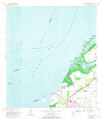
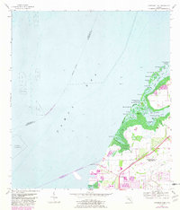
1956 Map of Cockroach Bay
USGS Topo · Published 1970About this map
Big Cockroach Mound and the intricate coastal wetlands of Cockroach Bay dominate this mid-century topographic profile. The landscape transitions from the deep open waters of Tampa Bay through a complex network of mangrove-lined passages such as Gooseneck Pass and Hole in the Wall Pass. On the landward side, the Seaboard rail line and the Coast Line road define the transportation corridor near the Hillsborough-Manatee county line. Large industrial footprints and dredging activity are evident in the designated spoil areas and the Anchorage for Explosives marked offshore. Inland development is sparse, with small creek systems like Curiosity Creek and Cockroach Creek draining the flatlands toward Piney Point and Moody Point, reflecting the region's character before the intensive residential expansion of later decades.
Find a feature on this map
42 named features on this map. Tap any name to fly to it.
Don’t see what you’re looking for? This feature index may not catch every label — zoom into the map to look around manually.
Map Details
Editions of this 1956 Cockroach Bay Map
5 editions found
Other maps of this area

1921 · Tampa
USGS Topo · 1:62,500

1921 · Fort De Soto
USGS Topo · 1:62,500

1921 · St Petersburg
USGS Topo · 1:62,500

1942 · Cockroach Bay
USGS Topo · 1:31,680

1943 · St Petersburg
USGS Topo · 1:31,680

1943 · Pass-A-Grille
USGS Topo · 1:31,680

1943 · Port Tampa
USGS Topo · 1:31,680

1944 · Anna Maria
USGS Topo · 1:31,680

1944 · Ruskin
USGS Topo · 1:31,680

1944 · Ellenton
USGS Topo · 1:31,680