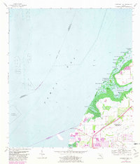
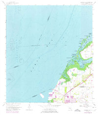
1956 Map of Cockroach Bay
USGS Topo · Published 1982About this map
Tampa Bay and the intricate shoreline of Cockroach Bay dominate this coastal survey, where the low-lying wetlands of Hillsborough County meet Manatee County. The landscape is a complex network of island clusters and tidal channels including Hallelujah Keys, Paradise Key, and Big Pass Key. A significant cultural landmark, the Big Cockroach Mound, sits at the mouth of the bay, suggesting the area's long human history prior to modern development. To the south, the industrial and transport footprint becomes evident at Piney Point, where the Seaboard rail line and a landing strip serve the coastal economy. The waters are further defined by specific maritime navigation features like Cockroach Channel and an offshore Anchorage for Explosives, reflecting the bay's strategic and commercial utility in the mid-20th century.
Find a feature on this map
44 named features on this map. Tap any name to fly to it.
Don’t see what you’re looking for? This feature index may not catch every label — zoom into the map to look around manually.
Map Details
Editions of this 1956 Cockroach Bay Map
5 editions found
Other maps of this area

1921 · Tampa
USGS Topo · 1:62,500

1921 · Fort De Soto
USGS Topo · 1:62,500

1921 · St Petersburg
USGS Topo · 1:62,500

1942 · Cockroach Bay
USGS Topo · 1:31,680

1943 · St Petersburg
USGS Topo · 1:31,680

1943 · Pass-A-Grille
USGS Topo · 1:31,680

1943 · Port Tampa
USGS Topo · 1:31,680

1944 · Anna Maria
USGS Topo · 1:31,680

1944 · Ruskin
USGS Topo · 1:31,680

1944 · Ellenton
USGS Topo · 1:31,680