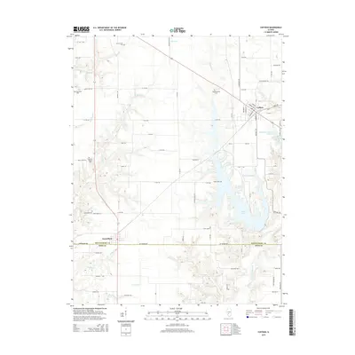
2015 Map of Coffeen
USGS Topo · Published 2015About this map
The sprawling waters of Coffeen Lake dominate the eastern half of this Montgomery County landscape, its jagged shoreline reaching into the drainage of E Fork Shoal Cr. Situated just north of the Bond Co line, the city of Coffeen serves as a local hub near the Rocky Ford Lakes. This 2015 survey reveals a terrain defined by agricultural grid roads and numerous small family or community cemeteries that reflect the area's deep roots, including McDavid Point Cem and the County Farm Cem near the northern boundary. In the southwest corner, the village of Donnellson sits at a crossroads, surrounded by historic sites such as Donnellson Cem and the nearby Edwards Chapel Cem. The map traces the intricate water network of Bearcat Cr and Waveland Cr as they cut through the rural Illinois prairie.
Find a feature on this map
76 named features on this map. Tap any name to fly to it.
Don’t see what you’re looking for? This feature index may not catch every label — zoom into the map to look around manually.
Map Details
Editions of this 2015 Coffeen Map
This is the sole edition of this map. No revisions or reprints were ever made.
Other maps of this area

1915 · Mount Olive
USGS Topo · 1:62,500

1932 · Greenville
USGS Topo · 1:62,500

1937 · New Douglas
USGS Topo · 1:48,000

1939 · Greenville
USGS Topo · 1:62,500

1943 · Greenville
USGS Topo · 1:62,500

1944 · New Douglas
USGS Topo · 1:62,500

1944 · Mount Olive
USGS Topo · 1:62,500

1947 · Hillsboro
USGS Topo · 1:62,500

1949 · Hillsboro
USGS Topo · 1:62,500

1958 · Decatur
USGS Topo · 1:250,000