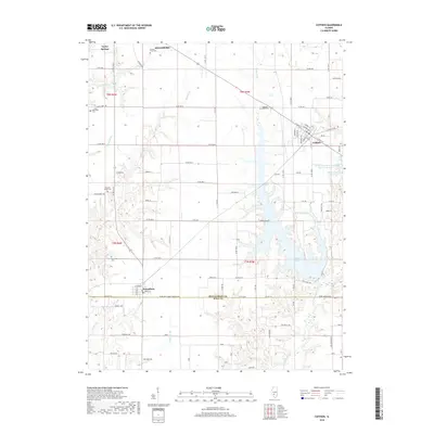
2018 Map of Coffeen
USGS Topo · Published 2018About this map
Coffeen Lake dominates the eastern half of this landscape, its sprawling, irregular shoreline branching out through the local drainage network including McDavid Br. The region is defined by the boundary between Montgomery County and Bond County, where small settlements like Coffeen, Donnellson, and Taylor Springs serve as hubs for the surrounding agricultural tracts. The map reveals a high density of small family or community burial sites, such as the Mansfield Cem, McDavid Point Cem, and the Traylor Cem, which provide significant genealogical value for those tracing local lineages.
Find a feature on this map
101 named features on this map. Tap any name to fly to it.
Don’t see what you’re looking for? This feature index may not catch every label — zoom into the map to look around manually.
Map Details
Editions of this 2018 Coffeen Map
This is the sole edition of this map. No revisions or reprints were ever made.
Other maps of this area

1915 · Mount Olive
USGS Topo · 1:62,500

1932 · Greenville
USGS Topo · 1:62,500

1937 · New Douglas
USGS Topo · 1:48,000

1939 · Greenville
USGS Topo · 1:62,500

1943 · Greenville
USGS Topo · 1:62,500

1944 · New Douglas
USGS Topo · 1:62,500

1944 · Mount Olive
USGS Topo · 1:62,500

1947 · Hillsboro
USGS Topo · 1:62,500

1949 · Hillsboro
USGS Topo · 1:62,500

1958 · Decatur
USGS Topo · 1:250,000