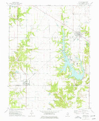
1974 Map of Coffeen
USGS Topo · Published 1977About this map
Coffeen Lake dominates this central Illinois landscape, its dendritic shoreline created by the flooding of East Fork and its tributaries including McDavid Branch. In the mid-1970s, the area reflects a transition toward heavy industrial utility, marked by the presence of a powerplant with a Powerplant Stack, Ash Disposal Ponds, and an extensive conveyor system. This energy infrastructure sits alongside established agricultural and extraction sites such as several Oil Wells and a claypit.
Find a feature on this map
39 named features on this map. Tap any name to fly to it.
Don’t see what you’re looking for? This feature index may not catch every label — zoom into the map to look around manually.
Map Details
Editions of this 1974 Coffeen Map
This is the sole edition of this map. No revisions or reprints were ever made.
Other maps of this area

1915 · Mount Olive
USGS Topo · 1:62,500

1932 · Greenville
USGS Topo · 1:62,500

1937 · New Douglas
USGS Topo · 1:48,000

1939 · Greenville
USGS Topo · 1:62,500

1943 · Greenville
USGS Topo · 1:62,500

1944 · New Douglas
USGS Topo · 1:62,500

1944 · Mount Olive
USGS Topo · 1:62,500

1947 · Hillsboro
USGS Topo · 1:62,500

1949 · Hillsboro
USGS Topo · 1:62,500

1958 · Decatur
USGS Topo · 1:250,000