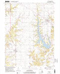
1998 Map of Coffeenn
USGS Topo · Published 2002About this map
Industrial infrastructure and rural landscapes intersect along the shores of Coffeen Lake, where the Powerplant Stack and an extensive Conveyor system dominate the central terrain. This late-twentieth-century landscape preserves a network of small settlements like Coffeen and Taylor Springs, while the surrounding countryside in Hillsboro and Grisham townships is dotted with numerous family and community burial grounds, including the McDavid Point Cem and the County Farm Cem. The map illustrates the specialized water management required for regional industry, featuring several Ash Disposal Ponds and Sewage Disposal Ponds. Natural drainage is provided by Shoal Creek and the East Fork, which wind through the irregular topography of La Grange and East Fork townships, reflecting the transition from agricultural use to modern utility operations.
Find a feature on this map
31 named features on this map. Tap any name to fly to it.
Don’t see what you’re looking for? This feature index may not catch every label — zoom into the map to look around manually.
Map Details
Editions of this 1998 Coffeenn Map
This is the sole edition of this map. No revisions or reprints were ever made.
Other maps of this area

1915 · Mount Olive
USGS Topo · 1:62,500

1932 · Greenville
USGS Topo · 1:62,500

1937 · New Douglas
USGS Topo · 1:48,000

1939 · Greenville
USGS Topo · 1:62,500

1943 · Greenville
USGS Topo · 1:62,500

1944 · New Douglas
USGS Topo · 1:62,500

1944 · Mount Olive
USGS Topo · 1:62,500

1947 · Hillsboro
USGS Topo · 1:62,500

1949 · Hillsboro
USGS Topo · 1:62,500

1958 · Decatur
USGS Topo · 1:250,000