
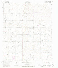
1962 Map of Cofferville
USGS Topo · Published 1965About this map
Cofferville and the surrounding high plains of Lamb County are defined by the shallow, winding course of Blackwater Draw in this 1962 aerial survey. The landscape is marked by a distinctive grid of agricultural development, featuring numerous water wells and a prominent industrial Pipeline cutting diagonally across the terrain. Local social life is anchored by the Rocky Ford Ch, while the economy is reflected in the specialized Sandpits found near the draw. This map captures the region at a moment of intensive groundwater-based farming, showing the fine-grained network of property lines and rural infrastructure that shaped this part of the Texas Panhandle.
Find a feature on this map
5 named features on this map. Tap any name to fly to it.
Don’t see what you’re looking for? This feature index may not catch every label — zoom into the map to look around manually.
Map Details
Editions of this 1962 Cofferville Map
2 editions found
Other maps of this area

1954 · Clovis
USGS Topo · 1:250,000

1954 · Brownfield
USGS Topo · 1:250,000

1957 · Anton
USGS Topo · 1:62,500

1958 · Brownfield
USGS Topo · 1:250,000

1958 · Clovis
USGS Topo · 1:250,000

1962 · Brownfield
USGS Topo · 1:250,000

1962 · Amherst
USGS Topo · 1:24,000

1962 · Springlake
USGS Topo · 1:24,000

1962 · Fieldton
USGS Topo · 1:24,000

1963 · Earth
USGS Topo · 1:24,000