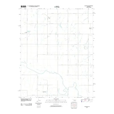
2009 Map of Cogar NE
USGS Topo · Published 2009About this map
The Canadian River meanders through this western Oklahoma landscape, carving a wide valley that defines the southern portion of the quadrangle. In the early 21st century, the area remains primarily rural and agricultural, organized by a rigid grid of section-line roads like S Heaston Rd and S Fort Reno Rd. Water management is central to the land's utility, evidenced by the Wayne Reuter Reservoir and its associated Wayne Reuter Dam, alongside the Dave Richardson Number 1 Dam. These man-made features contrast with the natural drainage patterns of Sixmile Creek and Fourmile Creek. Near the northern boundary, the Buena Vista Cemetery serves as a quiet landmark for local family history, while the El Reno Municipal Air Park at the eastern edge indicates the proximity of the regional hub.
Find a feature on this map
32 named features on this map. Tap any name to fly to it.
Don’t see what you’re looking for? This feature index may not catch every label — zoom into the map to look around manually.
Map Details
Editions of this 2009 Cogar NE Map
This is the sole edition of this map. No revisions or reprints were ever made.
Other maps of this area

1892 · Kingfisher
USGS Topo · 1:125,000

1893 · Fort Reno
USGS Topo · 1:62,500

1893 · Buggy Creek
USGS Topo · 1:62,500

1893 · Minco
USGS Topo · 1:62,500

1895 · Kingfisher
USGS Topo · 1:125,000

1904 · Chickasha
USGS Topo · 1:125,000

1941 · Fort Reno
USGS Topo · 1:62,500

1942 · Fort Reno
USGS Topo · 1:62,500

1949 · Fort Reno
USGS Topo · 1:62,500

1954 · Oklahoma City
USGS Topo · 1:250,000