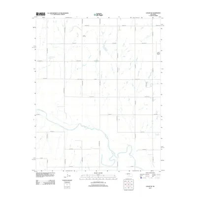
2012 Map of Cogar NE
USGS Topo · Published 2012About this map
The Canadian River snakes through this section of Canadian County, shaping a landscape of deep meanders and alluvial terrain just south of El Reno. This 2012 survey documents a rural environment organized by a rigorous section-line road grid, where large-scale infrastructure like the El Reno Regional Airport sits alongside long-established landmarks. To the northwest, the Buena Vista Cem serves as a significant point of reference for local family history, while the Wayne Reuter Reservoir and Fourmile Cr represent the vital water resources managed within this agricultural corridor. The map reflects a modern period of rural transition, with named thoroughfares like Prairie View Ln and W OKC Reno St connecting dispersed homesteads and farms to the larger transportation network of central Oklahoma.
Find a feature on this map
34 named features on this map. Tap any name to fly to it.
Don’t see what you’re looking for? This feature index may not catch every label — zoom into the map to look around manually.
Map Details
Editions of this 2012 Cogar NE Map
This is the sole edition of this map. No revisions or reprints were ever made.
Other maps of this area

1892 · Kingfisher
USGS Topo · 1:125,000

1893 · Fort Reno
USGS Topo · 1:62,500

1893 · Buggy Creek
USGS Topo · 1:62,500

1893 · Minco
USGS Topo · 1:62,500

1895 · Kingfisher
USGS Topo · 1:125,000

1904 · Chickasha
USGS Topo · 1:125,000

1941 · Fort Reno
USGS Topo · 1:62,500

1942 · Fort Reno
USGS Topo · 1:62,500

1949 · Fort Reno
USGS Topo · 1:62,500

1954 · Oklahoma City
USGS Topo · 1:250,000