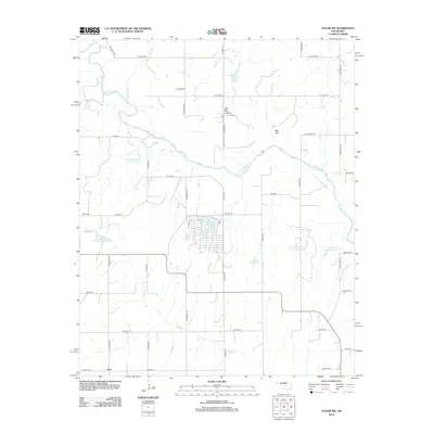
2012 Map of Cogar NW
USGS Topo · Published 2012About this map
Canadian River meanders across this rural Caddo County landscape, carving a wide valley through the Oklahoma plains south of Red Hill. The area is defined by its agricultural water management, evidenced by numerous private reservoirs named for local landowners, such as the Frenchie Hickman Number 1 Reservoir, Eugene Powers Reservoir, and the Charles Freeman Number 1 Reservoir. These water features, alongside Cedar Lake, suggest a land deeply tied to irrigation and livestock.
Find a feature on this map
41 named features on this map. Tap any name to fly to it.
Don’t see what you’re looking for? This feature index may not catch every label — zoom into the map to look around manually.
Map Details
Editions of this 2012 Cogar NW Map
This is the sole edition of this map. No revisions or reprints were ever made.
Other maps of this area

1893 · Fort Reno
USGS Topo · 1:62,500

1893 · Buggy Creek
USGS Topo · 1:62,500

1941 · Fort Reno
USGS Topo · 1:62,500

1942 · Fort Reno
USGS Topo · 1:62,500

1942 · Geary
USGS Topo · 1:62,500

1949 · Fort Reno
USGS Topo · 1:62,500

1951 · Binger
USGS Topo · 1:62,500

1955 · Clinton
USGS Topo · 1:250,000

1957 · Clinton
USGS Topo · 1:250,000

1967 · Fort Reno SW
USGS Topo · 1:24,000