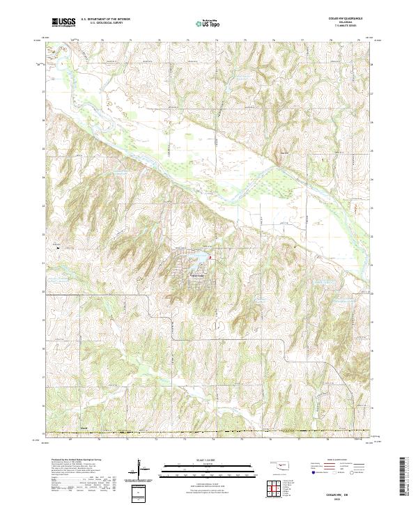
2022 Map of Cogar NW
USGS Topo · Published 2022About this map
Cedar Lake and its surrounding community form the heart of this landscape, situated south of the braided channels of the Canadian River. This 2022 survey illustrates a region defined by an extensive network of water management features, including several family-named impoundments such as Chester Chiles Reservoir, Eugene Powers Reservoir, and the Frenchie Hickman Number 1 Reservoir. These sites, along with Buggy Creek and Powder Face Cr, trace the drainage patterns through the local topography.
Find a feature on this map
50 named features on this map. Tap any name to fly to it.
Don’t see what you’re looking for? This feature index may not catch every label — zoom into the map to look around manually.
Map Details
Editions of this 2022 Cogar NW Map
This is the sole edition of this map. No revisions or reprints were ever made.
Other maps of this area

1893 · Fort Reno
USGS Topo · 1:62,500

1893 · Buggy Creek
USGS Topo · 1:62,500

1941 · Fort Reno
USGS Topo · 1:62,500

1942 · Fort Reno
USGS Topo · 1:62,500

1942 · Geary
USGS Topo · 1:62,500

1949 · Fort Reno
USGS Topo · 1:62,500

1951 · Binger
USGS Topo · 1:62,500

1955 · Clinton
USGS Topo · 1:250,000

1957 · Clinton
USGS Topo · 1:250,000

1967 · Fort Reno SW
USGS Topo · 1:24,000