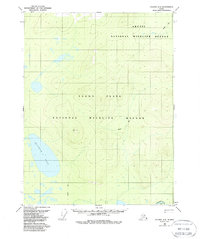
1956 Map of Coleen A-5
USGS Topo · Published 1988About this map
Yukon Flats dominates this portion of interior Alaska, characterized by a complex network of wetlands and seasonal water bodies. The expansive Graphite Lake serves as a major landmark in the western half of the sheet, while the Porcupine River cuts through the extreme southeast corner near Deacons Rock. This mid-century survey, based on 1955 aerial photography, illustrates the remote character of the territory before the formalization of major conservation boundaries. The map marks a traditional Winter Trail snaking across the landscape, providing a rare trace of human transit through the alluvial basin. Survey markers like VABM Nancy provide fixed points of reference in an otherwise fluid terrain of shifting swamps and low-relief flats, now protected within the Arctic National Wildlife Refuge and the Yukon Flats National Wildlife Refuge.
Find a feature on this map
8 named features on this map. Tap any name to fly to it.
Don’t see what you’re looking for? This feature index may not catch every label — zoom into the map to look around manually.
Map Details
Editions of this 1956 Coleen A-5 Map
3 editions found
Other maps of this area

1951 · Black River
USGS Topo · 1:250,000

1951 · Coleen
USGS Topo · 1:250,000

1956 · Coleen
USGS Topo · 1:250,000

1956 · Black River D-6
USGS Topo · 1:63,360

1956 · Coleen A-5
USGS Topo · 1:63,360

1956 · Black River D-4
USGS Topo · 1:63,360

1956 · Black River D-5
USGS Topo · 1:63,360
1956 · Coleen A-6
USGS Topo · 1:63,360

1956 · Coleen A-4
USGS Topo · 1:63,360

1956 · Black River
USGS Topo · 1:250,000