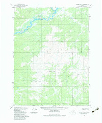
1983 Map of Coleen C-6
USGS Topo · Published 1983About this map
The Sheenjek River and Koness River dominate the northern landscape of this interior Alaska territory, where their braided channels move through low-lying wetlands. Established within the Arctic National Wildlife Refuge, this region reflects the federal land management policies set forth by the Alaska National Interest Lands Conservation Act of 1980. The topographic detail, compiled from 1972 aerial photography, shows the character of the river valleys before they transition into the higher elevations near Rainbow. The survey highlights a wilderness area defined by natural drainage patterns and topographical relief rather than human settlement, preserving a record of the Brooks Range foothills in the early 1980s.
Find a feature on this map
4 named features on this map. Tap any name to fly to it.
Don’t see what you’re looking for? This feature index may not catch every label — zoom into the map to look around manually.
Map Details
Editions of this 1983 Coleen C-6 Map
This is the sole edition of this map. No revisions or reprints were ever made.
Other maps of this area

1951 · Coleen
USGS Topo · 1:250,000

1951 · Christian
USGS Topo · 1:250,000

1956 · Coleen
USGS Topo · 1:250,000

1956 · Christian
USGS Topo · 1:250,000
1972 · Coleen D-5
USGS Topo · 1:63,360

1972 · Coleen D-6
USGS Topo · 1:63,360
1973 · Christian D-1
USGS Topo · 1:63,360
1983 · Christian C-1
USGS Topo · 1:63,360
1990 · Coleen B-5
USGS Topo · 1:63,360
1990 · Christian B-1
USGS Topo · 1:63,360