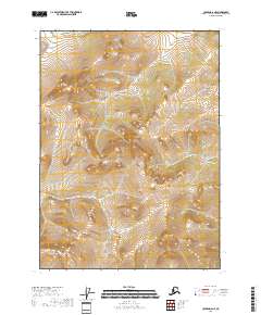
2018 Map of Coleen D-6 NE
USGS Topo · Published 2018About this map
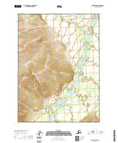
The high-elevation landscape of the T36n R18e and T37n R18e townships in Alaska’s interior defines this 2018 survey. Dominated by significant relief, the map reveals a remote terrain shaped by sharp elevation changes and high mountain ridgelines, which are recorded with twenty-foot contour intervals. This quadrangle provides an exacting look at the Public Land Survey System divisions in the Yukon-Koyukuk region, showing the convergence of township lines such as T37n R17e and T36n R19e. The absence of named settlements or roads highlights the wilderness character of this area north of the Arctic Circle, where the landscape is primarily defined by the natural drainage patterns and the geometry of the T35n R18e and T35n R19e survey blocks.
Find a feature on this map
6 named features on this map. Tap any name to fly to it.
Don’t see what you’re looking for? This feature index may not catch every label — zoom into the map to look around manually.
Map Details
Editions of this 2018 Coleen D-6 NE Map
This is the sole edition of this map. No revisions or reprints were ever made.
Other maps of this area

1951 · Coleen
USGS Topo · 1:250,000

1951 · Table Mountain
USGS Topo · 1:250,000

1956 · Table Mountain
USGS Topo · 1:250,000

1956 · Coleen
USGS Topo · 1:250,000

1964 · Table Mountain
USGS Topo · 1:250,000
1972 · Coleen D-5
USGS Topo · 1:63,360
1972 · Table Mountain A-5
USGS Topo · 1:63,360

1972 · Coleen D-6
USGS Topo · 1:63,360
2018 · Coleen D-6 SE
USGS Topo · 1:25,000
2018 · Coleen D-5 NW
USGS Topo · 1:25,000