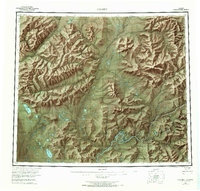
1956 Map of Coleen
USGS Topo · Published 1966About this map
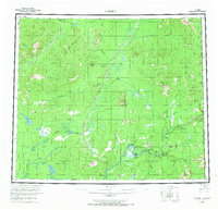
The Porcupine River carves a deep path through the northeastern Alaska interior, defining the drainage patterns of this subarctic wilderness. In the mid-1950s, human presence was concentrated at remote outposts along the riverbanks, including the Old Rampart settlement and Owens Cabins. The landscape is dominated by high peaks and ridges such as Shoulder Mountain and Seven Dikes Mountain, while the Coleen River and Sheenjek River provide the primary water routes through the northern valleys. Significant landmarks like Howling Dog Rock and Halfway Pillar served as critical navigation points along the twisting watercourses. A solitary Tractor Trail offers one of the few terrestrial corridors through the tundra, connecting the low-lying Chandalar Flats to the higher elevations near Rabbit Mountain. This survey was conducted just as the Arctic Nat Wildlife Ref began to formalize conservation in this international border region along the United States Canada boundary.
Find a feature on this map
41 named features on this map. Tap any name to fly to it.
Don’t see what you’re looking for? This feature index may not catch every label — zoom into the map to look around manually.
Map Details
Editions of this 1956 Coleen Map
9 editions found
Other maps of this area

1951 · Fort Yukon
USGS Topo · 1:250,000

1951 · Black River
USGS Topo · 1:250,000

1951 · Coleen
USGS Topo · 1:250,000

1951 · Christian
USGS Topo · 1:250,000

1951 · Arctic
USGS Topo · 1:250,000

1951 · Table Mountain
USGS Topo · 1:250,000

1956 · Table Mountain
USGS Topo · 1:250,000

1956 · Coleen
USGS Topo · 1:250,000

1956 · Arctic
USGS Topo · 1:250,000

1956 · Coleen B-2
USGS Topo · 1:63,360