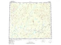
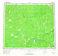
1956 Map of Coleen
USGS Topo · Published 1983About this map
The Porcupine River and Coleen River dominate this interior Alaskan landscape, which spans the transition from the Yukon Flats into the high Brooks Range foothills. In this 1950s survey, the area is defined by a sparse network of watercourses and seasonal paths, notably a Tractor Trail cutting through the western terrain near Grayling Creek. Small outposts like Old Rampart and Old Camp sit along the winding riverbanks, marking the limited human presence in what is now part of the Arctic National Wildlife Refuge. The map identifies numerous family-named or descriptive landmarks, from Henry Martin Island to Strangle Woman Creek. Topographically, the land rises to prominent summits such as Spike Mountain and Seven Dikes Mountain, while the Upper Ramparts create a narrow passage for the Porcupine as it flows toward the Canadian border at the Alaska Yukon boundary.
Find a feature on this map
57 named features on this map. Tap any name to fly to it.
Don’t see what you’re looking for? This feature index may not catch every label — zoom into the map to look around manually.
Map Details
Editions of this 1956 Coleen Map
9 editions found
Other maps of this area

1951 · Fort Yukon
USGS Topo · 1:250,000

1951 · Black River
USGS Topo · 1:250,000

1951 · Coleen
USGS Topo · 1:250,000

1951 · Christian
USGS Topo · 1:250,000

1951 · Arctic
USGS Topo · 1:250,000

1951 · Table Mountain
USGS Topo · 1:250,000

1956 · Table Mountain
USGS Topo · 1:250,000

1956 · Coleen
USGS Topo · 1:250,000

1956 · Arctic
USGS Topo · 1:250,000

1956 · Coleen B-2
USGS Topo · 1:63,360