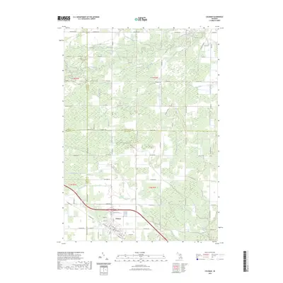
2023 Map of Coleman
USGS Topo · Published 2023About this map
Coleman sits at the junction of Midland, Isabella, Gladwin, and Clare counties, serving as a focal point for this landscape of agricultural drains and small waterways. The city's grid is detailed with local street names like W Railway St, Shelter St, and W Webster St, reflecting its historical development along transportation corridors. Outside the city center, the terrain is defined by a dense network of managed water systems, including the Lyle Drain, Davidson Creek, and Bluff Creek, which flow through the surrounding rural blocks. A notable Railroad Grade cuts through the northern sections, tracing a path through the townships of the T17N R2W and T17N R3W surveys. This map reveals how the landscape is segmented by county lines and a complex system of drainage, such as High Drain and Bickerton Drain, which are vital to the local land use and boundary history of this Michigan region.
Find a feature on this map
58 named features on this map. Tap any name to fly to it.
Don’t see what you’re looking for? This feature index may not catch every label — zoom into the map to look around manually.
Map Details
Editions of this 2023 Coleman Map
This is the sole edition of this map. No revisions or reprints were ever made.
Other maps of this area

1930 · Shepherd
USGS Topo · 1:48,000

1934 · Sanford
USGS Topo · 1:62,500

1936 · Shepherd
USGS Topo · 1:62,500

1936 · Sanford
USGS Topo · 1:62,500

1954 · Midland
USGS Topo · 1:250,000

1958 · Midland
USGS Topo · 1:250,000

1959 · Midland
USGS Topo · 1:250,000

1966 · Midland
USGS Topo · 1:250,000

1969 · Gladwin
USGS Topo · 1:24,000

1969 · Coleman
USGS Topo · 1:24,000