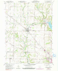
1960 Map of College Corner
USGS Topo · Published 1990About this map
The borderlands of Indiana and Ohio center on College Corner, a settlement uniquely divided by the State Line Principal Meridian. This 1960 survey, updated with mid-1970s revisions, illustrates the rural landscape before extensive modern development, highlighting the confluence of rail and road through the Baltimore and Ohio line. To the east, the recreational expanses of Hueston Woods State Park and Acton Lake dominate the terrain, while the western side is defined by agricultural lands and small hamlets like Cottage Grove and West College Corner.
Find a feature on this map
40 named features on this map. Tap any name to fly to it.
Don’t see what you’re looking for? This feature index may not catch every label — zoom into the map to look around manually.
Map Details
Editions of this 1960 College Corner Map
4 editions found
Other maps of this area

1911 · Oxford
USGS Topo · 1:62,500

1915 · College Corner
USGS Topo · 1:48,000

1915 · Harrison
USGS Topo · 1:48,000

1915 · Hamilton
USGS Topo · 1:62,500

1917 · Hamilton
USGS Topo · 1:62,500

1918 · College Corner
USGS Topo · 1:62,500

1948 · Fairfield
USGS Topo · 1:24,000

1953 · Cincinnati
USGS Topo · 1:250,000

1955 · Reily
USGS Topo · 1:24,000

1955 · Mount Carmel
USGS Topo · 1:24,000