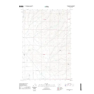
2020 Map of Colockum Pass SE
USGS Topo · Published 2020About this map
Whiskey Dick Mtn rises above a landscape defined by the drainage networks of the eastern Kittitas Valley. This 2020 survey documents the transition from high ridgelines to the irrigation infrastructure necessary for agriculture, most notably the North Branch Canal which cuts through the southern sections. The map reveals a complex system of seasonal and perennial waterways including Whiskey Jim Cr, Caribou Cr, and Park Cr, which have carved out features like Black Rock Canyon and Spring Gulch.
Find a feature on this map
29 named features on this map. Tap any name to fly to it.
Don’t see what you’re looking for? This feature index may not catch every label — zoom into the map to look around manually.
Map Details
Editions of this 2020 Colockum Pass SE Map
This is the sole edition of this map. No revisions or reprints were ever made.
Other maps of this area

1920 · Colockum Pass
USGS Topo · 1:125,000

1922 · Colockum Pass
USGS Topo · 1:125,000

1938 · Badger Pocket
USGS Topo · 1:48,000

1939 · Boylston
USGS Topo · 1:48,000

1943 · Boylston
USGS Topo · 1:62,500

1943 · Badger Pocket
USGS Topo · 1:62,500

1950 · Yakima
USGS Topo · 1:250,000
1953 · East Kittitas
USGS Topo · 1:24,000

1953 · Kittitas
USGS Topo · 1:24,000
1953 · Boylston
USGS Topo · 1:24,000