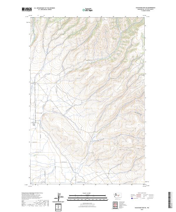
2023 Map of Colockum Pass SE
USGS Topo · Published 2023About this map
The eastern reaches of the Kittitas Valley meet the rising slopes of Whiskey Dick Mtn in this contemporary record of the central Washington landscape. The map illustrates a complex relationship between natural drainages and managed water systems, notably where the North Branch Canal cuts across the western foothills. Numerous seasonal and perennial watercourses, including Cooke Creek, Caribou Creek, and the curiously named Whiskey Jim Creek, carve deep into the terrain. A network of rural roads such as Brick Mill Rd, Christensen Rd, and Lyons Rd serve the low-lying agricultural areas, while more remote tracks like Secret Canyon Rd and Hyergrass Ranches Rd climb into the canyons and gulches that characterize the eastern half of the quadrangle.
Find a feature on this map
31 named features on this map. Tap any name to fly to it.
Don’t see what you’re looking for? This feature index may not catch every label — zoom into the map to look around manually.
Map Details
Editions of this 2023 Colockum Pass SE Map
This is the sole edition of this map. No revisions or reprints were ever made.
Other maps of this area

1920 · Colockum Pass
USGS Topo · 1:125,000

1922 · Colockum Pass
USGS Topo · 1:125,000

1938 · Badger Pocket
USGS Topo · 1:48,000

1939 · Boylston
USGS Topo · 1:48,000

1943 · Boylston
USGS Topo · 1:62,500

1943 · Badger Pocket
USGS Topo · 1:62,500

1950 · Yakima
USGS Topo · 1:250,000
1953 · East Kittitas
USGS Topo · 1:24,000

1953 · Kittitas
USGS Topo · 1:24,000
1953 · Boylston
USGS Topo · 1:24,000