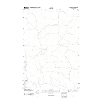
2011 Map of Colstrip East
USGS Topo · Published 2011About this map
Colstrip anchoring the southwest corner of this Montana landscape reveals the expansion of residential streets such as Willow Ave, Box Elder Ave, and Rosebud Ln near the banks of East Fork Armells Creek. The terrain is defined by a dendritic drainage system of seasonal watercourses, including Sprague Creek and Spring Creek, which carve through the high plains. A prominent landmark, Eagle Rock, stands north of the main settlement area, overlooking the intersection of local roads and the southward-flowing Pony Creek. The map also captures the Colstrip Cemetery on the northwestern edge of town, providing a point of reference for local genealogical research and historical land use. This 2011 survey illustrates the modern footprint of a community deeply tied to the natural resources and geography of Rosebud County.
Find a feature on this map
15 named features on this map. Tap any name to fly to it.
Don’t see what you’re looking for? This feature index may not catch every label — zoom into the map to look around manually.
Map Details
Editions of this 2011 Colstrip East Map
This is the sole edition of this map. No revisions or reprints were ever made.
Other maps of this area

1954 · Hardin
USGS Topo · 1:250,000

1954 · Forsyth
USGS Topo · 1:250,000

1957 · Hardin
USGS Topo · 1:250,000

1957 · Forsyth
USGS Topo · 1:250,000

1958 · Forsyth
USGS Topo · 1:250,000

1958 · Hardin
USGS Topo · 1:250,000

1971 · Colstrip SW
USGS Topo · 1:24,000

1971 · Colstrip SE
USGS Topo · 1:24,000

1971 · Hammond Draw NW
USGS Topo · 1:24,000

1971 · Colstrip East
USGS Topo · 1:24,000