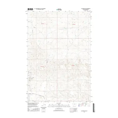
2017 Map of Colstrip East
USGS Topo · Published 2017About this map
Colstrip anchoring the southwestern edge of this Rosebud County landscape, the terrain transitions from the residential street grids of Willow Ave and Wagoneer Dr into a complex network of intermittent drainages. The Colstrip Cem serves as a significant local landmark on the outskirts of the town's expanding residential footprint. To the north and east, the landscape is defined by the high point of Eagle Rock and the winding paths of Sprague Cr, Pony Cr, and Cow Cr. These seasonal watercourses carve through the sections of T3N and T2N, illustrating the topographic character of the coal country region. Rural access is maintained via family-named thoroughfares like Wilmer Ranch Rd and functional routes such as Water Rd, which navigate the rises between the creek beds.
Find a feature on this map
23 named features on this map. Tap any name to fly to it.
Don’t see what you’re looking for? This feature index may not catch every label — zoom into the map to look around manually.
Map Details
Editions of this 2017 Colstrip East Map
This is the sole edition of this map. No revisions or reprints were ever made.
Other maps of this area

1954 · Hardin
USGS Topo · 1:250,000

1954 · Forsyth
USGS Topo · 1:250,000

1957 · Hardin
USGS Topo · 1:250,000

1957 · Forsyth
USGS Topo · 1:250,000

1958 · Forsyth
USGS Topo · 1:250,000

1958 · Hardin
USGS Topo · 1:250,000

1971 · Colstrip SW
USGS Topo · 1:24,000

1971 · Colstrip SE
USGS Topo · 1:24,000

1971 · Hammond Draw NW
USGS Topo · 1:24,000

1971 · Colstrip East
USGS Topo · 1:24,000