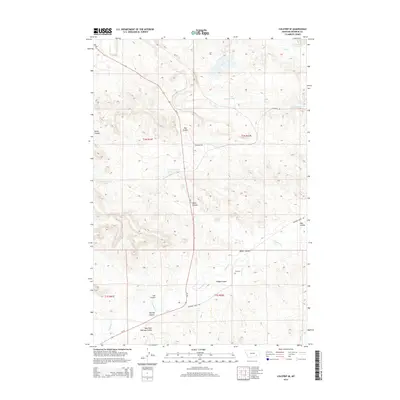
2014 Map of Colstrip SE
USGS Topo · Published 2014About this map
Rosebud Creek flows through this corner of Rosebud County, Montana, carving a landscape defined by an extensive network of named drainages and coulees. The terrain is characterized by the convergence of several significant draws, including Lee Coulee, Miller Coulee, and Dobbs Coulee, which all direct seasonal runoff toward the primary creek bed. This 2014 survey captures the rural ranching character of the region, where infrastructure is limited to established routes like Rosebud Creek Road and State Highway 39. Evidence of early settlement and family legacy remains visible at the Lee Cemetery, located on a rise overlooking the creek valley. Further north, the drainage basin of Cow Creek and its South Fork dominates the topography, supported by several recorded water sources such as Spring 01N42E04AC01. The map provides a precise record of Section, Township, and Range lines, marking out the vast, open acreage of this part of Big Sky Country.
Find a feature on this map
22 named features on this map. Tap any name to fly to it.
Don’t see what you’re looking for? This feature index may not catch every label — zoom into the map to look around manually.
Map Details
Editions of this 2014 Colstrip SE Map
This is the sole edition of this map. No revisions or reprints were ever made.
Other maps of this area

1954 · Hardin
USGS Topo · 1:250,000

1957 · Hardin
USGS Topo · 1:250,000

1958 · Hardin
USGS Topo · 1:250,000

1958 · Garfield Peak
USGS Topo · 1:24,000

1958 · Jimtown
USGS Topo · 1:24,000

1958 · Badger Peak
USGS Topo · 1:24,000

1971 · Colstrip SW
USGS Topo · 1:24,000

1971 · Colstrip SE
USGS Topo · 1:24,000

1971 · Hammond Draw NW
USGS Topo · 1:24,000

1971 · Colstrip East
USGS Topo · 1:24,000