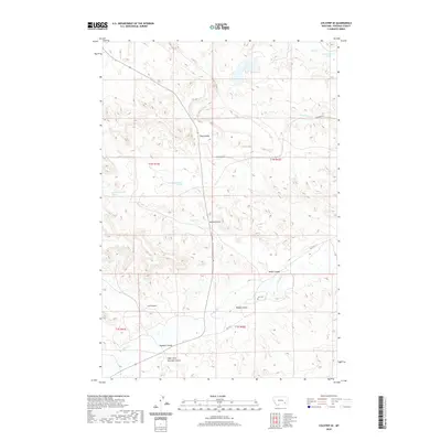
2020 Map of Colstrip SE
USGS Topo · Published 2020About this map
Rosebud Creek flows through the southern reaches of this Rosebud County landscape, marking a terrain defined by an extensive network of drainage coulees. The presence of Lee Cemetery near the creek's bank suggests a long-standing ranching or pioneer presence in this corner of Montana. Significant water sources like Cow Creek, South Fork Cow Creek, and Hay Coulee break up the high ground, while modern infrastructure is represented by Rte 447 and Cowcreek Road. This map documents a series of specifically named landmarks, including Emile Coulee, Miller Coulee, and Dobbs Coulee, providing essential geographic detail for those tracing family ties or land use in the region. The map also identifies several springs, such as 01N41E24CCAA01 Spring, which are critical features in this arid environment.
Find a feature on this map
20 named features on this map. Tap any name to fly to it.
Don’t see what you’re looking for? This feature index may not catch every label — zoom into the map to look around manually.
Map Details
Editions of this 2020 Colstrip SE Map
This is the sole edition of this map. No revisions or reprints were ever made.
Other maps of this area

1954 · Hardin
USGS Topo · 1:250,000

1957 · Hardin
USGS Topo · 1:250,000

1958 · Hardin
USGS Topo · 1:250,000

1958 · Garfield Peak
USGS Topo · 1:24,000

1958 · Jimtown
USGS Topo · 1:24,000

1958 · Badger Peak
USGS Topo · 1:24,000

1971 · Colstrip SW
USGS Topo · 1:24,000

1971 · Colstrip SE
USGS Topo · 1:24,000

1971 · Hammond Draw NW
USGS Topo · 1:24,000

1971 · Colstrip East
USGS Topo · 1:24,000