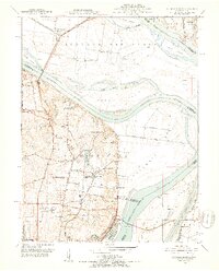
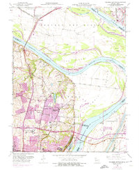
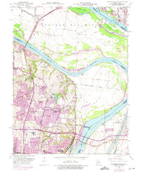
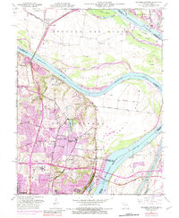
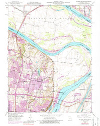
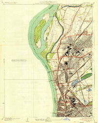
1951 Map of Columbia Bottom
USGS Topo · Published 1952About this map
Columbia Bottom lies at the historic confluence of the mid-continent's two greatest waterways, where the Missouri River meets the Mississippi River north of St. Louis. In the early 1950s, this lowland landscape is a complex network of levees, islands, and chutes, including the large Cora Island and Chouteau Island. The area reflects a transition from river-dependent industry and institutions to early suburban growth. Notable landmarks include the Fort Bellefontaine site and the sprawling St Louis State Training School, alongside specialized facilities like the City of St Louis Bellefontaine Farm and the Villa Gesu Convent. Transportation infrastructure is dense here, with the Illinois Terminal RR and Chicago Burlington and Quincy railroads crossing the bottomlands, while the Chain of Rocks Bridge provides a vital link across the Mississippi toward Illinois.
Find a feature on this map
58 named features on this map. Tap any name to fly to it.
Don’t see what you’re looking for? This feature index may not catch every label — zoom into the map to look around manually.
Map Details
Editions of this 1951 Columbia Bottom Map
8 editions found
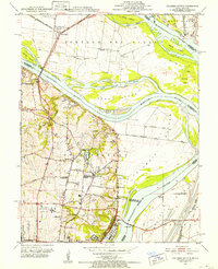
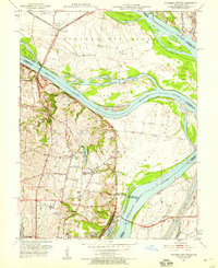
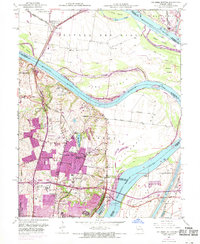
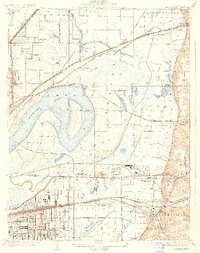
Other maps of this area

1888 · St. Louis
USGS Topo · 1:62,500

1927 · Alton
USGS Topo · 1:62,500

1927 · St. Charles
USGS Topo · 1:62,500

1933 · Granite City
USGS Topo · 1:24,000

1933 · Clayton
USGS Topo · 1:24,000

1933 · Saint Charles
USGS Topo · 1:62,500

1934 · Alton
USGS Topo · 1:62,500
1935 · Granite City
USGS Topo · 1:24,000

1935 · Florissant
USGS Topo · 1:24,000
1935 · Monks Mound
USGS Topo · 1:24,000