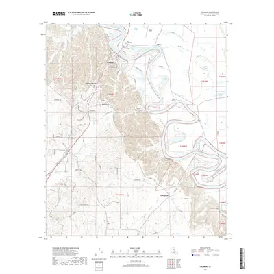
2018 Map of Columbia
USGS Topo · Published 2018About this map
The Ouachita River snakes through Caldwell Parish in dramatic loops and oxbows, defining the landscape between Columbia and Copenhagen. This river-centric geography is dotted with several backwater lakes and brakes, such as Brandon Lake and Thompson Brake, which reflect the dynamic nature of the waterway’s alluvial plain. On the higher ground west of the river, the residential patterns of Columbia Heights, Banks Springs, and Grayson are clearly delineated along the highway corridor.
Find a feature on this map
90 named features on this map. Tap any name to fly to it.
Don’t see what you’re looking for? This feature index may not catch every label — zoom into the map to look around manually.
Map Details
Editions of this 2018 Columbia Map
This is the sole edition of this map. No revisions or reprints were ever made.
Other maps of this area

1939 · Fort Necessity
USGS Topo · 1:62,500

1940 · Columbia
USGS Topo · 1:62,500

1941 · Harrisonburg
USGS Topo · 1:62,500

1953 · Alexandria
USGS Topo · 1:250,000

1953 · Natchez
USGS Topo · 1:250,000

1955 · Jackson
USGS Topo · 1:250,000

1955 · Shreveport
USGS Topo · 1:250,000

1955 · Alexandria
USGS Topo · 1:250,000

1955 · Olla
USGS Topo · 1:62,500

1956 · Shreveport
USGS Topo · 1:250,000