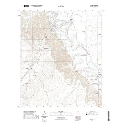
2020 Map of Columbia
USGS Topo · Published 2020About this map
Columbia sits as the central hub of this Caldwell Parish landscape, defined by the winding course of the Ouachita River which carves through the terrain to create Grandview Bluff. The river's influence is evident in the many surrounding water bodies like Indian Slough, Brown Lake, and the uniquely named Dizzy Brake. Civic and community history is anchored by the Caldwell Parish Courthouse and a network of local burial grounds including Columbia Hill Cem, Saint Peter Cem, and Welcome Home Cem. To the south and west, the settlements of Grayson, Columbia Heights, and Banks Springs are connected by a grid of residential and rural roads such as Old Alexandria Rd and Rushing St. This documentation illustrates the modern rural structure of the parish, balancing the developed corridors near the Caldwell Parish Airport with the low-lying wetlands of Sillars Bayou and Thompson Bayou.
Find a feature on this map
83 named features on this map. Tap any name to fly to it.
Don’t see what you’re looking for? This feature index may not catch every label — zoom into the map to look around manually.
Map Details
Editions of this 2020 Columbia Map
This is the sole edition of this map. No revisions or reprints were ever made.
Other maps of this area

1939 · Fort Necessity
USGS Topo · 1:62,500

1940 · Columbia
USGS Topo · 1:62,500

1941 · Harrisonburg
USGS Topo · 1:62,500

1953 · Alexandria
USGS Topo · 1:250,000

1953 · Natchez
USGS Topo · 1:250,000

1955 · Jackson
USGS Topo · 1:250,000

1955 · Shreveport
USGS Topo · 1:250,000

1955 · Alexandria
USGS Topo · 1:250,000

1955 · Olla
USGS Topo · 1:62,500

1956 · Shreveport
USGS Topo · 1:250,000