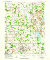
1962 Map of Columbiana
USGS Topo · Published 1964About this map
The Mahoning Co Columbiana Co line bisects this landscape, illustrating the intersection of the Connecticut Western Reserve to the north and the Congress Lands to the south. The city of Columbiana serves as a hub in the south, where Firestone Park and the Dixon Sch are established near the Pennsylvania railroad line. To the north, the industrial character of the era is evident in the numerous Strip Mine and Slag Mine operations scattered between North Lima and Woodworth.
Find a feature on this map
66 named features on this map. Tap any name to fly to it.
Don’t see what you’re looking for? This feature index may not catch every label — zoom into the map to look around manually.
Map Details
Editions of this 1962 Columbiana Map
3 editions found
Other maps of this area

1906 · Youngstown
USGS Topo · 1:62,500

1907 · Columbiana
USGS Topo · 1:62,500

1908 · Youngstown
USGS Topo · 1:62,500

1908 · Warren
USGS Topo · 1:62,500

1909 · Lisbon
USGS Topo · 1:62,500

1909 · Columbiana
USGS Topo · 1:62,500

1950 · Cleveland
USGS Topo · 1:250,000

1951 · Canton
USGS Topo · 1:250,000

1951 · Columbiana
USGS Topo · 1:24,000

1951 · Campbell
USGS Topo · 1:24,000