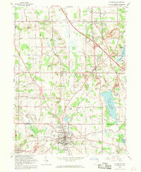
1962 Map of Columbiana
USGS Topo · Published 1970About this map
Columbiana sits at the southern edge of this landscape, where the Youngstown and Southern Railway intersects with a network of local roads crossing the Mahoning Co Columbiana Co line. The map reveals a post-war landscape of expanding residential pockets like North Lima and Woodworth set against a backdrop of industrial activity. Extensive strip mine operations and several quarries are visible, particularly near Morgantown and Willow Crest, indicating the heavy reliance on mineral extraction during this period.
Find a feature on this map
66 named features on this map. Tap any name to fly to it.
Don’t see what you’re looking for? This feature index may not catch every label — zoom into the map to look around manually.
Map Details
Editions of this 1962 Columbiana Map
3 editions found
Other maps of this area

1906 · Youngstown
USGS Topo · 1:62,500

1907 · Columbiana
USGS Topo · 1:62,500

1908 · Youngstown
USGS Topo · 1:62,500

1908 · Warren
USGS Topo · 1:62,500

1909 · Lisbon
USGS Topo · 1:62,500

1909 · Columbiana
USGS Topo · 1:62,500

1950 · Cleveland
USGS Topo · 1:250,000

1951 · Canton
USGS Topo · 1:250,000

1951 · Columbiana
USGS Topo · 1:24,000

1951 · Campbell
USGS Topo · 1:24,000