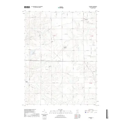
2018 Map of Columbus
USGS Topo · Published 2018About this map
Columbus and Burton anchor this western Illinois landscape, where the rural topography of Adams County is defined by a dense network of small burial grounds and winding creek beds. This area preserves a significant concentration of local history through its numerous cemeteries, including Columbus Cem, Saint Joseph Cem, and the Independence Cem, which reflect the early settlement patterns of the region. The terrain is deeply etched by watercourses such as McKee Cr and Tourneur Cr, creating a complex series of ridges and valleys that contrast with the modern expansion of the Quincy Regional Airport-Baldwin Field. The road network follows a rigid section-line grid typical of the Midwest, yet frequently deviates to navigate the natural breaks formed by Mill Cr and Burton Cr.
Find a feature on this map
56 named features on this map. Tap any name to fly to it.
Don’t see what you’re looking for? This feature index may not catch every label — zoom into the map to look around manually.
Map Details
Editions of this 2018 Columbus Map
This is the sole edition of this map. No revisions or reprints were ever made.
Other maps of this area

1925 · Quincy
USGS Topo · 1:62,500

1925 · Liberty
USGS Topo · 1:62,500

1927 · Liberty
USGS Topo · 1:62,500

1944 · Quincy
USGS Topo · 1:62,500

1945 · Quincy
USGS Topo · 1:62,500

1946 · Mendon
USGS Topo · 1:62,500

1948 · Quincy
USGS Topo · 1:250,000

1948 · Mendon
USGS Topo · 1:62,500

1948 · Camp Point
USGS Topo · 1:62,500

1956 · Quincy
USGS Topo · 1:250,000