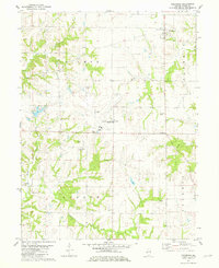
1981 Map of Columbus
USGS Topo · Published 1981About this map
The Quincy Municipal Airport (Baldwin Field) serves as a prominent modern landmark in this Illinois landscape, which remains deeply tied to its rural townships. The map details the intersection of Gilmer, Columbus, and Burton townships, where the terrain is carved by the drainages of McKee Creek, Mill Creek, and Lick Creek. These waterways dictate the placement of local infrastructure and older settlements like the community of Burton and the crossroads at Five Points.
Find a feature on this map
27 named features on this map. Tap any name to fly to it.
Don’t see what you’re looking for? This feature index may not catch every label — zoom into the map to look around manually.
Map Details
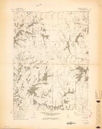
Editions of this 1981 Columbus Map
2 editions found
Other maps of this area

1925 · Quincy
USGS Topo · 1:62,500

1925 · Liberty
USGS Topo · 1:62,500

1927 · Liberty
USGS Topo · 1:62,500

1944 · Quincy
USGS Topo · 1:62,500

1945 · Quincy
USGS Topo · 1:62,500

1946 · Mendon
USGS Topo · 1:62,500

1948 · Quincy
USGS Topo · 1:250,000

1948 · Mendon
USGS Topo · 1:62,500

1948 · Camp Point
USGS Topo · 1:62,500

1956 · Quincy
USGS Topo · 1:250,000