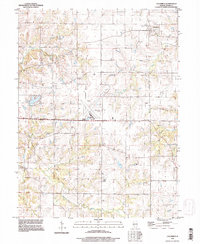
1995 Map of Columbus
USGS Topo · Published 1998About this map
Columbus and the surrounding rural townships of Adams County define this mid-1990s landscape, where small crossroads settlements and agricultural sections are linked by a network of creeks and country roads. The central portion of the map is dominated by the sprawling infrastructure of the Quincy Municipal Airport (Baldwin Field), including its runways and associated Comm Towers. Away from the aviation hub, the terrain is carved by Mill Creek and McKee Creek, which wind through the townships of Gilmer and Columbus. For those researching local family history, several prominent burial grounds are documented across the countryside, including Mt Pleasant Cem near the center and Independence Cem to the south. These cemeteries, alongside small clusters of buildings at Burton and Five Points, offer a clear look at the late 20th-century distribution of communities in western Illinois.
Find a feature on this map
22 named features on this map. Tap any name to fly to it.
Don’t see what you’re looking for? This feature index may not catch every label — zoom into the map to look around manually.
Map Details
Editions of this 1995 Columbus Map
This is the sole edition of this map. No revisions or reprints were ever made.
Other maps of this area

1925 · Quincy
USGS Topo · 1:62,500

1925 · Liberty
USGS Topo · 1:62,500

1927 · Liberty
USGS Topo · 1:62,500

1944 · Quincy
USGS Topo · 1:62,500

1945 · Quincy
USGS Topo · 1:62,500

1946 · Mendon
USGS Topo · 1:62,500

1948 · Quincy
USGS Topo · 1:250,000

1948 · Mendon
USGS Topo · 1:62,500

1948 · Camp Point
USGS Topo · 1:62,500

1956 · Quincy
USGS Topo · 1:250,000