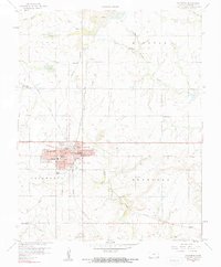
1958 Map of Columbus
USGS Topo · Published 1959About this map
Columbus serves as the focal point of this Cherokee County survey, characterized by its grid of schools and the prominent Courthouse at the town center. The landscape is heavily marked by the region's industrial heritage, with numerous Strip Mine excavations scattered across the townships of Ross, Mineral, and Salamanca. This mining activity is closely tied to the extensive rail network, including the St Louis San Francisco and the Oklahoma Northeast Kansas lines, which serviced the various mine sites and small communities like Stippville and Turck.
Find a feature on this map
36 named features on this map. Tap any name to fly to it.
Don’t see what you’re looking for? This feature index may not catch every label — zoom into the map to look around manually.
Map Details
Editions of this 1958 Columbus Map
2 editions found
Other maps of this area

1886 · Joplin
USGS Topo · 1:125,000

1894 · Joplin
USGS Topo · 1:125,000

1918 · Columbus
USGS Topo · 1:62,500

1943 · Cherokee
USGS Topo · 1:62,500

1945 · Pittsburg
USGS Topo · 1:62,500

1945 · Cherokee
USGS Topo · 1:62,500

1947 · Joplin
USGS Topo · 1:250,000

1947 · Pittsburg
USGS Topo · 1:62,500

1949 · Joplin
USGS Topo · 1:250,000

1950 · Pittsburg
USGS Topo · 1:62,500