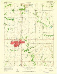
1958 Map of Columbus
USGS Topo · Published 1959About this map
The town of Columbus serves as a dense hub of civic and educational life in Cherokee County, featuring a central Courthouse, High Sch, and the St Rose Sch. The surrounding landscape is defined by a grid of small school districts and rural settlements, reflecting a mid-century agricultural community transitioning through industrial shifts. Heavy extraction activity is evident to the north and east, where extensive Strip Mine operations scar the terrain near Stippville and Skidmore.
Find a feature on this map
37 named features on this map. Tap any name to fly to it.
Don’t see what you’re looking for? This feature index may not catch every label — zoom into the map to look around manually.
Map Details
Editions of this 1958 Columbus Map
2 editions found
Other maps of this area

1886 · Joplin
USGS Topo · 1:125,000

1894 · Joplin
USGS Topo · 1:125,000

1918 · Columbus
USGS Topo · 1:62,500

1943 · Cherokee
USGS Topo · 1:62,500

1945 · Pittsburg
USGS Topo · 1:62,500

1945 · Cherokee
USGS Topo · 1:62,500

1947 · Joplin
USGS Topo · 1:250,000

1947 · Pittsburg
USGS Topo · 1:62,500

1949 · Joplin
USGS Topo · 1:250,000

1950 · Pittsburg
USGS Topo · 1:62,500