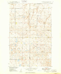
1949 Map of Columbus SW
USGS Topo · Published 1949About this map
Glacial prairie potholes and industrial activity define this northern North Dakota landscape along the Divide Co / Burke Co border. Surveyed shortly after World War II, the map documents an era of rural transition where traditional small-school districts, including School No 1 and School No 2, still dotted the plains. In the northern reaches, the Coal Field indicates the region's mineral wealth, specifically featuring a Strip Mine that suggests the scale of local extraction. The social fabric of these townships is captured through landmarks like South St Olaf Ch and the Prairie Chapel Cem, while the terrain itself is organized into distinct areas such as Keller, Harmonious, and Border. The density of small water bodies and marshes across the quadrangle reflects the characteristic prairie pothole topography of the High Plains.
Find a feature on this map
13 named features on this map. Tap any name to fly to it.
Don’t see what you’re looking for? This feature index may not catch every label — zoom into the map to look around manually.
Map Details
Editions of this 1949 Columbus SW Map
3 editions found
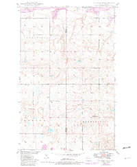
Other maps of this area

1947 · Noonan
USGS Topo · 1:24,000

1947 · Columbus
USGS Topo · 1:24,000

1949 · Columbus SW
USGS Topo · 1:24,000

1949 · Atcoal
USGS Topo · 1:24,000

1949 · Columbus
USGS Topo · 1:24,000

1949 · Noonan SE
USGS Topo · 1:24,000

1949 · Columbus SE
USGS Topo · 1:24,000

1949 · Noonan
USGS Topo · 1:24,000

1950 · Columbus
USGS Topo · 1:62,500

1950 · Noonan
USGS Topo · 1:62,500