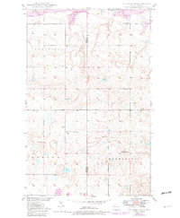
1949 Map of Columbus SW
USGS Topo · Published 1982About this map
Prairie Chapel and its adjacent Prairie Chapel Cem stand as central landmarks in this rural landscape along the Divide Co Burke Co line. Surveyed in the late 1940s, the terrain is defined by the high-plains agriculture of the Border and Harmonius townships, punctuated by a series of numbered local schoolhouses including School No 1, School No 2, and School No 4. The northern reaches of the quadrangle reveal the regional industrial footprint with an active Strip Mine located within the Coalfield district. This map documents a transitional period in North Dakota's geography, showing the Missouri River Basin development era through the lens of traditional rural settlements, where family life centered around places like the South St Olaf Ch.
Find a feature on this map
12 named features on this map. Tap any name to fly to it.
Don’t see what you’re looking for? This feature index may not catch every label — zoom into the map to look around manually.
Map Details
Editions of this 1949 Columbus SW Map
3 editions found
Other maps of this area

1947 · Noonan
USGS Topo · 1:24,000

1947 · Columbus
USGS Topo · 1:24,000

1949 · Columbus SW
USGS Topo · 1:24,000

1949 · Atcoal
USGS Topo · 1:24,000

1949 · Columbus
USGS Topo · 1:24,000

1949 · Noonan SE
USGS Topo · 1:24,000

1949 · Columbus SE
USGS Topo · 1:24,000

1949 · Noonan
USGS Topo · 1:24,000

1950 · Columbus
USGS Topo · 1:62,500

1950 · Noonan
USGS Topo · 1:62,500