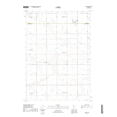
2019 Map of Comfrey
USGS Topo · Published 2019About this map
Comfrey sits at the northern edge of this agricultural landscape, straddling the border of Brown and Cottonwood counties. The town serves as a focal point for the surrounding farm country, which is meticulously organized by a grid of rural roads including County Highway 17 and County Highway 23. This 2019 survey documents the enduring presence of local landmarks like the Congregational Cemetery and the Christian Reformed Cemetery, providing important touchstones for genealogists and local historians studying the area's pioneer heritage.
Find a feature on this map
25 named features on this map. Tap any name to fly to it.
Don’t see what you’re looking for? This feature index may not catch every label — zoom into the map to look around manually.
Map Details
Editions of this 2019 Comfrey Map
This is the sole edition of this map. No revisions or reprints were ever made.
Other maps of this area

1953 · New Ulm
USGS Topo · 1:250,000

1954 · Fairmont
USGS Topo · 1:250,000

1957 · New Ulm
USGS Topo · 1:250,000

1958 · New Ulm
USGS Topo · 1:250,000

1958 · Fairmont
USGS Topo · 1:250,000

1967 · New Ulm
USGS Topo · 1:250,000

1967 · Sanborn SE
USGS Topo · 1:24,000

1967 · Springfield
USGS Topo · 1:24,000

1967 · Sanborn NE
USGS Topo · 1:24,000

1967 · Darfur
USGS Topo · 1:24,000