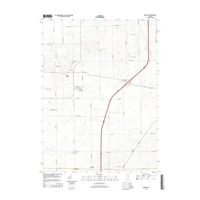
2015 Map of Compton
USGS Topo · Published 2015About this map
Compton anchors the center of this agricultural landscape in the 2010s, situated at the intersection of Chicago Rd and Route 251. The village street grid is clearly defined by W Walnut St, W Chestnut St, W Main St, and W Cherry St. Moving outward, the landscape is defined by the headwaters of Big Bureau Cr and Fourmile Grove Cr, which carve through the grid of section roads like Stainbrook Rd and Cottage Hill Rd.
Find a feature on this map
49 named features on this map. Tap any name to fly to it.
Don’t see what you’re looking for? This feature index may not catch every label — zoom into the map to look around manually.
Map Details
Editions of this 2015 Compton Map
This is the sole edition of this map. No revisions or reprints were ever made.
Other maps of this area

1934 · De Kalb
USGS Topo · 1:62,500

1937 · De Kalb
USGS Topo · 1:62,500

1951 · Earlville
USGS Topo · 1:62,500

1952 · Rochelle
USGS Topo · 1:62,500

1952 · Mendota
USGS Topo · 1:62,500

1958 · Aurora
USGS Topo · 1:250,000

1961 · Aurora
USGS Topo · 1:250,000
1971 · Lee
USGS Topo · 1:24,000
1971 · Paw Paw
USGS Topo · 1:24,000
1971 · Earlville
USGS Topo · 1:24,000