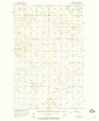
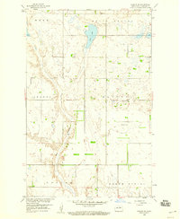
1957 Map of Comstock
USGS Topo · Published 1958About this map
Lake Ibsen dominates the northern landscape of this North Dakota prairie in the late 1950s, where the Missouri River Basin development program documented a shifting agricultural and rail corridor. Two major rail lines, the Northern Pacific and the Minneapolis St Paul and Sault Ste Marie, intersect near the small settlement of Comstock, illustrating the importance of transport for this grain-growing region. The landscape is characterized by its pothole lakes and undulating terrain features like The Buttes, while local community life is anchored by rural institutions such as School No 4, Gallinger Sch No 1, and the Wilmerth Cem. These features, along with the drainage of Big Coulee, reveal the intersection of early twentieth-century rail expansion and mid-century land management.
Find a feature on this map
16 named features on this map. Tap any name to fly to it.
Don’t see what you’re looking for? This feature index may not catch every label — zoom into the map to look around manually.
Map Details
Editions of this 1957 Comstock Map
2 editions found
Other maps of this area

1953 · Devils Lake
USGS Topo · 1:250,000

1956 · Devils Lake
USGS Topo · 1:250,000

1956 · Brinsmade
USGS Topo · 1:24,000

1957 · Comstock
USGS Topo · 1:24,000
1957 · Brinsmade
USGS Topo · 1:24,000
1958 · Minnewaukan West
USGS Topo · 1:24,000
1958 · Brinsmade SW
USGS Topo · 1:24,000

1958 · Harlow
USGS Topo · 1:24,000
1958 · Harlow SE
USGS Topo · 1:24,000

1971 · York
USGS Topo · 1:24,000