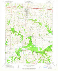
1962 Map of Concordia
USGS Topo · Published 1963About this map
St Pauls College and the town of Concordia serve as the focal point of this early 1960s survey, showing the community just as the modern highway system was being etched into the landscape. The Missouri Pacific railroad cuts through the northern townships, paralleling the older routes that once dictated the local economy. Southward, the terrain transitions into the fertile bottomlands of the Blackwater River, a meandering waterway defined by features like Horseshoe Lake and the Gaging Station.
Find a feature on this map
26 named features on this map. Tap any name to fly to it.
Don’t see what you’re looking for? This feature index may not catch every label — zoom into the map to look around manually.
Map Details
Editions of this 1962 Concordia Map
3 editions found
Other maps of this area

1885 · Warrensburg
USGS Topo · 1:125,000

1887 · Sedalia
USGS Topo · 1:125,000

1887 · Warrensburg
USGS Topo · 1:125,000

1889 · Lexington
USGS Topo · 1:125,000

1890 · Marshall
USGS Topo · 1:125,000

1892 · Marshall
USGS Topo · 1:125,000

1894 · Sedalia
USGS Topo · 1:125,000

1894 · Warrensburg
USGS Topo · 1:125,000

1901 · Marshall
USGS Topo · 1:125,000

1917 · Knobnoster
USGS Topo · 1:62,500