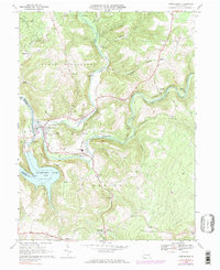
1967 Map of Confluence
USGS Topo · Published 1983About this map
The Casselman River and Laurel Hill Creek converge at the borough of Confluence, a critical transport hub defined by the intersecting paths of the Baltimore and Ohio and Western Maryland railroads. This 1967 survey captures the deep-cut valleys and high ridges of Lower Turkeyfoot and Upper Turkeyfoot, where small settlements like Ursina and Harnedsville are tied to the river's path. To the south, the massive expanse of the Youghiogheny River Lake marks a significant change in the local geography, created by the damming of the river just downstream.
Find a feature on this map
45 named features on this map. Tap any name to fly to it.
Don’t see what you’re looking for? This feature index may not catch every label — zoom into the map to look around manually.
Map Details
Editions of this 1967 Confluence Map
4 editions found
Other maps of this area

1899 · Grantsville
USGS Topo · 1:62,500

1900 · Accident
USGS Topo · 1:62,500

1904 · Grantsville
USGS Topo · 1:62,500

1921 · Meyersdale
USGS Topo · 1:62,500

1922 · Confluence
USGS Topo · 1:62,500

1931 · Confluence
USGS Topo · 1:62,500

1933 · Confluence
USGS Topo · 1:62,500

1939 · Meyersdale
USGS Topo · 1:62,500

1944 · Meyersdale
USGS Topo · 1:62,500

1946 · Grantsville
USGS Topo · 1:24,000
Featured Places
- Confluence, PA
- Ursina, PA
- Addison Township, PA
- Upper Turkeyfoot Township, PA
- Draketown, Lower Turkeyfoot Township