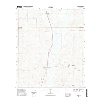
2015 Map of Converse
USGS Topo · Published 2015About this map
The boundary between De Soto Parish and Sabine Parish bisects this northern Louisiana landscape, where the village of Converse serves as a central hub. The area is defined by a dense network of timber and farm roads, including historically evocative names like Cotton Gin Rd and Old Union Church Rd. To the north, the settlement of Benson sits along the highway corridor, while Sebastian Cem remains a solitary landmark in the northern uplands. The terrain transitions toward the east into smaller communities such as Oak Grove, Mitchell, and Sardis. A few scattered water features like Drake Lake dot the countryside, which is primarily characterized by the undulating ridges and drainage patterns typical of the region's piney woods and agricultural hinterlands.
Find a feature on this map
32 named features on this map. Tap any name to fly to it.
Don’t see what you’re looking for? This feature index may not catch every label — zoom into the map to look around manually.
Map Details
Editions of this 2015 Converse Map
This is the sole edition of this map. No revisions or reprints were ever made.
Other maps of this area

1941 · Zwolle
USGS Topo · 1:62,500

1941 · Pelican
USGS Topo · 1:62,500

1943 · Pleasant Hill
USGS Topo · 1:62,500

1944 · Logansport
USGS Topo · 1:62,500

1944 · Patroon
USGS Topo · 1:62,500

1944 · Zwolle
USGS Topo · 1:62,500

1944 · Pleasant Hill
USGS Topo · 1:62,500

1953 · Alexandria
USGS Topo · 1:250,000

1955 · Alexandria
USGS Topo · 1:250,000

1956 · Logansport
USGS Topo · 1:62,500