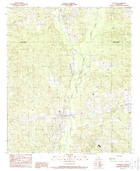
1989 Map of Converse
USGS Topo · Published 1989About this map
Converse sits at the heart of this landscape along the border of De Soto Parish and Sabine Parish during the late 1980s. The region is defined by its deep colonial roots and modern industrial extraction, most notably marked by the extensive Las Hormigas Grant which covers a significant portion of the central terrain. This historical land grant is bisected by the north-south drainage of San Patricio Bayou and Bear Creek, while active Oil Fields appear in the north and southwest, indicating the area's continued economic reliance on subsurface resources.
Find a feature on this map
23 named features on this map. Tap any name to fly to it.
Don’t see what you’re looking for? This feature index may not catch every label — zoom into the map to look around manually.
Map Details
Editions of this 1989 Converse Map
This is the sole edition of this map. No revisions or reprints were ever made.
Other maps of this area

1941 · Zwolle
USGS Topo · 1:62,500

1941 · Pelican
USGS Topo · 1:62,500

1943 · Pleasant Hill
USGS Topo · 1:62,500

1944 · Logansport
USGS Topo · 1:62,500

1944 · Patroon
USGS Topo · 1:62,500

1944 · Zwolle
USGS Topo · 1:62,500

1944 · Pleasant Hill
USGS Topo · 1:62,500

1953 · Alexandria
USGS Topo · 1:250,000

1955 · Alexandria
USGS Topo · 1:250,000

1956 · Logansport
USGS Topo · 1:62,500