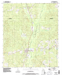
1994 Map of Converse
USGS Topo · Published 1996About this map
Converse sits at the heart of this North Louisiana landscape, where the boundary between De Soto Parish and Sabine Parish cuts across a complex network of bayous and creeks. This mid-1990s record captures the region's rural character, dominated by the drainage systems of San Patricio Bayou and Bear Bayou. The map details the small-town layout of Converse alongside outlying settlements like Benson, Oak Grove, and Mitchell.
Find a feature on this map
23 named features on this map. Tap any name to fly to it.
Don’t see what you’re looking for? This feature index may not catch every label — zoom into the map to look around manually.
Map Details
Editions of this 1994 Converse Map
This is the sole edition of this map. No revisions or reprints were ever made.
Other maps of this area

1941 · Zwolle
USGS Topo · 1:62,500

1941 · Pelican
USGS Topo · 1:62,500

1943 · Pleasant Hill
USGS Topo · 1:62,500

1944 · Logansport
USGS Topo · 1:62,500

1944 · Patroon
USGS Topo · 1:62,500

1944 · Zwolle
USGS Topo · 1:62,500

1944 · Pleasant Hill
USGS Topo · 1:62,500

1953 · Alexandria
USGS Topo · 1:250,000

1955 · Alexandria
USGS Topo · 1:250,000

1956 · Logansport
USGS Topo · 1:62,500