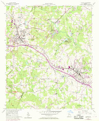
1956 Map of Conyers
USGS Topo · Published 1969About this map
Lithonia and Conyers anchor this mid-century survey of the De Kalb and Rockdale county line, where the landscape is defined by the granite outcroppings of Arabia Mountain and Pine Mountain. The Georgia Railroad cuts through the terrain, serving the numerous quarries that drove the local economy. Between the settled town centers, a network of rural life is visible through institutions like the Bruce St School and many country sanctuaries, including Union Grove Church and Whites Chapel.
Find a feature on this map
54 named features on this map. Tap any name to fly to it.
Don’t see what you’re looking for? This feature index may not catch every label — zoom into the map to look around manually.
Map Details
Editions of this 1956 Conyers Map
5 editions found
Other maps of this area

1888 · Atlanta
USGS Topo · 1:125,000

1890 · Atlanta
USGS Topo · 1:125,000

1892 · Atlanta
USGS Topo · 1:125,000

1895 · Atlanta
USGS Topo · 1:125,000

1896 · Monroe
USGS Topo · 1:125,000

1953 · Atlanta
USGS Topo · 1:250,000

1953 · Athens
USGS Topo · 1:250,000

1956 · Stone Mountain
USGS Topo · 1:24,000

1956 · Snellville
USGS Topo · 1:24,000

1956 · Conyers
USGS Topo · 1:24,000