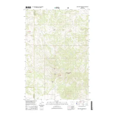
2017 Map of Cook Creek Reservoir
USGS Topo · Published 2017About this map
Custer National Forest lands dominate this section of the Montana landscape, straddling the high divide between the Rosebud and Powder River county lines. The area is defined by a complex network of draws and coulees, including Houston Draw and Rice Coulee, which serve as natural catchments in an arid environment. Water management is central to the land's utility, evidenced by the numerous named water sources such as JO Spring, Bringoff Spring, and Daily Creek Spring. These springs and seasonal drainages like Bringoff Cr feed into small-scale impoundments like Shy Reservoir and Cottonwood Reservoir. At the southern end, Cook Mtn rises above the Cook Cr Reservoir, providing a topographical anchor for the surrounding terrain and the intricate headwaters of Cook Cr.
Find a feature on this map
29 named features on this map. Tap any name to fly to it.
Don’t see what you’re looking for? This feature index may not catch every label — zoom into the map to look around manually.
Map Details
Editions of this 2017 Cook Creek Reservoir Map
This is the sole edition of this map. No revisions or reprints were ever made.
Other maps of this area

1954 · Hardin
USGS Topo · 1:250,000

1957 · Hardin
USGS Topo · 1:250,000

1958 · Hardin
USGS Topo · 1:250,000

1966 · Coleman Draw
USGS Topo · 1:24,000

1966 · Ashland
USGS Topo · 1:24,000

1966 · Beaver Creek School
USGS Topo · 1:24,000

1966 · Cook Creek Reservoir
USGS Topo · 1:24,000

1966 · Willow Crossing
USGS Topo · 1:24,000

1966 · Ashland NE
USGS Topo · 1:24,000

1971 · Hammond Draw
USGS Topo · 1:24,000