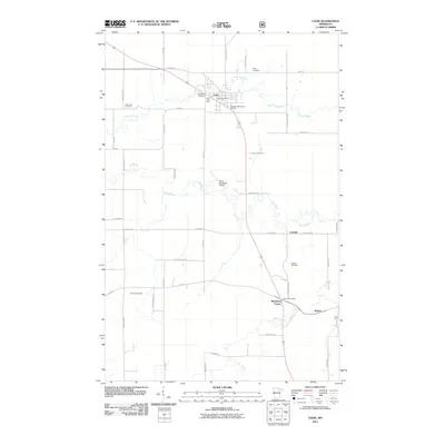
2011 Map of Cook
USGS Topo · Published 2011About this map
The Little Fork River and Rice River converge in this northern Minnesota landscape, anchoring the settlement of Cook. This early 21st-century survey reveals a transition from the structured town grid surrounding the Cook Post Office to the winding waterways and rural road networks of the surrounding Iron Range country. Small communities like Leander, Shermans Corner, and Angora dot the highway corridors, while the presence of several burial grounds, including Little Fork Cemetery, Alango Cemetery, and Hillside Cemetery, provides significant data points for local genealogists. The map also documents regional infrastructure, from the Cook Municipal Airport to local landmarks like Vermilion Fairways and the Vermilion Motel and RV Park, reflecting the intersection of local industry and northern tourism.
Find a feature on this map
45 named features on this map. Tap any name to fly to it.
Don’t see what you’re looking for? This feature index may not catch every label — zoom into the map to look around manually.
Map Details
Editions of this 2011 Cook Map
This is the sole edition of this map. No revisions or reprints were ever made.
Other maps of this area

1951 · Britt
USGS Topo · 1:24,000

1952 · Idington
USGS Topo · 1:24,000

1954 · Hibbing
USGS Topo · 1:250,000

1955 · Dark Lake
USGS Topo · 1:24,000

1957 · Hibbing
USGS Topo · 1:250,000

1958 · Hibbing
USGS Topo · 1:250,000

1964 · Hibbing
USGS Topo · 1:250,000

1964 · Linden Grove
USGS Topo · 1:24,000

1964 · Haley
USGS Topo · 1:24,000

1964 · Gheen
USGS Topo · 1:24,000